
home
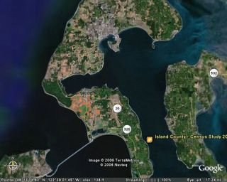
Oh I found a new toy!! Google Earth. It is so cool!! This is a picture of our island. At least it is a picture of the middle part of our island. It is 70 miles long, and this is the middle 20 or so. COupeville is up towards the top on the water edge, and My home is down towards the lower right hand part. you can see the long brown strip which is the airfield, and I am just below that. The green is all forest. It was easy to download, and set up and I have been having a ball all day playing with it.
maybe I will go back and put the whole island on here.

Whidbey Island in Puget Sound
OK...The Base is up towards the top of the island, you can see the airstrips. THe field they bounce on is where I live. Phyllis lives in Coupeville, and the lines connecting the island to the mainland are not bridges they are ferries...each takes about 30 minutes to cross the sound. Seattle is down just below the right edge.
Now, where do YOU live?
1 comment:
if you get tired of Google Earth there is also Google Mars.
http://www.google.com/mars/
Post a Comment